9 Stunning Valley of Fire Hikes You Can’t Miss
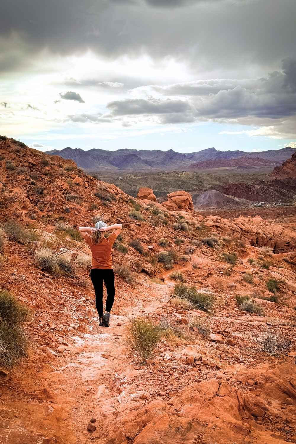
The Valley of Fire has some of the best hikes in Nevada, in my opinion. It’s a landscape of fiery red rock formations, swirling sandstone, and hidden slot canyons.
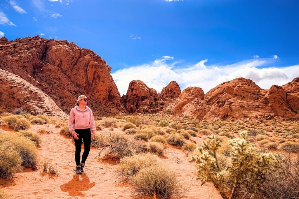
I’ve had this small but mighty Nevada state park on my bucket list for years, and when I found myself with a couple of free days before a convention in Las Vegas, I knew I had to finally go. Two days, countless miles, and a whole lot of rock scrambling later, I can confidently say this park blew me away.
Valley of Fire is like a bite-sized version of Utah’s national parks, packed with awesome trails, red rock formations, and ancient petroglyphs. I hiked almost every trail, taking my time to explore, take in the views, and discover what makes each one special.
Whether you have just a few hours or an entire weekend, there’s a trail for you.
In this post, I’m sharing nine of my favorite Valley of Fire hikes to help you pick the best ones for your trip. Whether you want an easy scenic walk or a longer adventure, I’ve got you covered.
Hiking is, without a doubt, one of the best ways to explore Valley of Fire, so let’s dive in!
Snapshot of Valley of Fire Hikes 📸
Most Scenic Trail: Seven Wonders Loop
Best For Slot Canyons: White Domes Trail
Best For Petroglyphs: Mouse’s Tank Road
Longest Trail: Prospect
Shortest Trail: Balancing Rock
My Favorite Trail: White Domes Trail

Where is the Valley of Fire State Park Located?
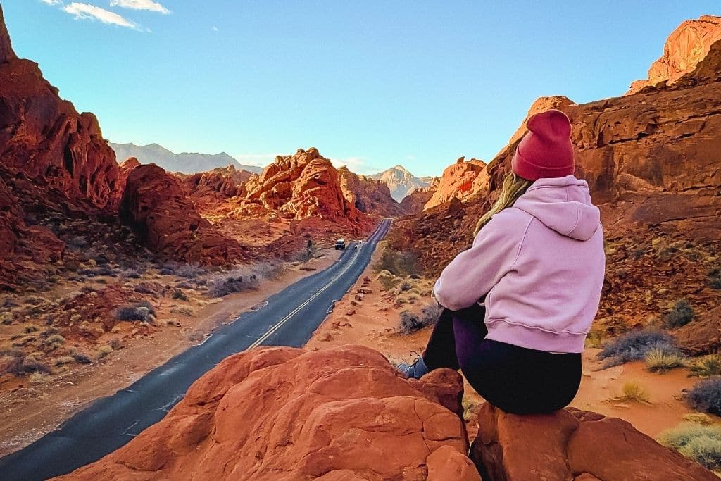
Valley of Fire State Park is in the southern tip of Nevada, not far from the Utah and Arizona borders. It’s about an hour from Las Vegas, making it an easy day trip but a completely different world from the city.
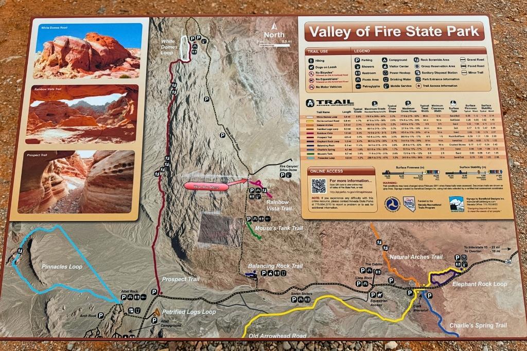
The park has two entrances, and once you’re inside, there’s no cell service, so be sure to download maps ahead of time. You’ll get a brochure when you enter, but it’s pretty basic—I recommend stopping by the visitor center to grab a detailed trail map.
Also, keep in mind that there are no gas stations or food options in the park, so stock up before you go!
Key Info for Visiting Valley of Fire
- Open every day from sunrise to sunset
- Open year-round
- Entry is $10 per vehicle for Nevada residents, $15 for out-of-state visitors
- No cell service, but you can buy WiFi at the visitor center
- Pets are welcome but must be on a leash
The 9 Best Valley of Fire Hikes
After spending two days hiking almost every trail, I’ve narrowed it down to my nine favorites to help you make the most of your visit. Here they are.
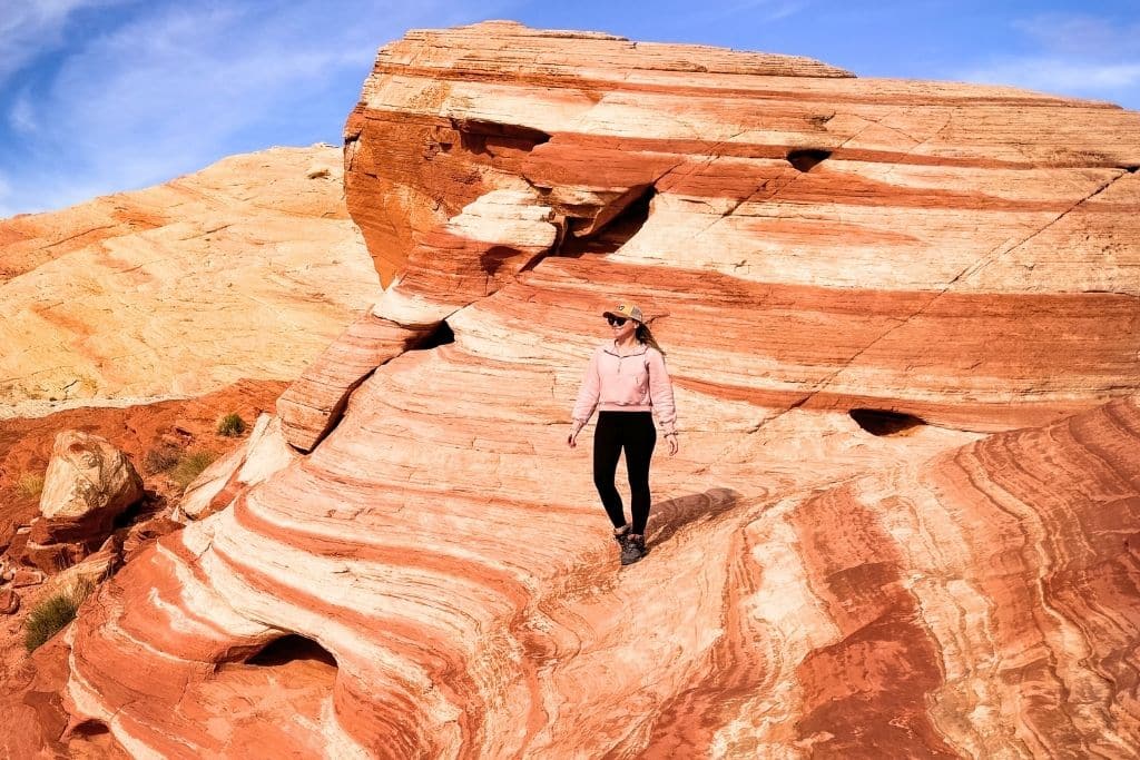
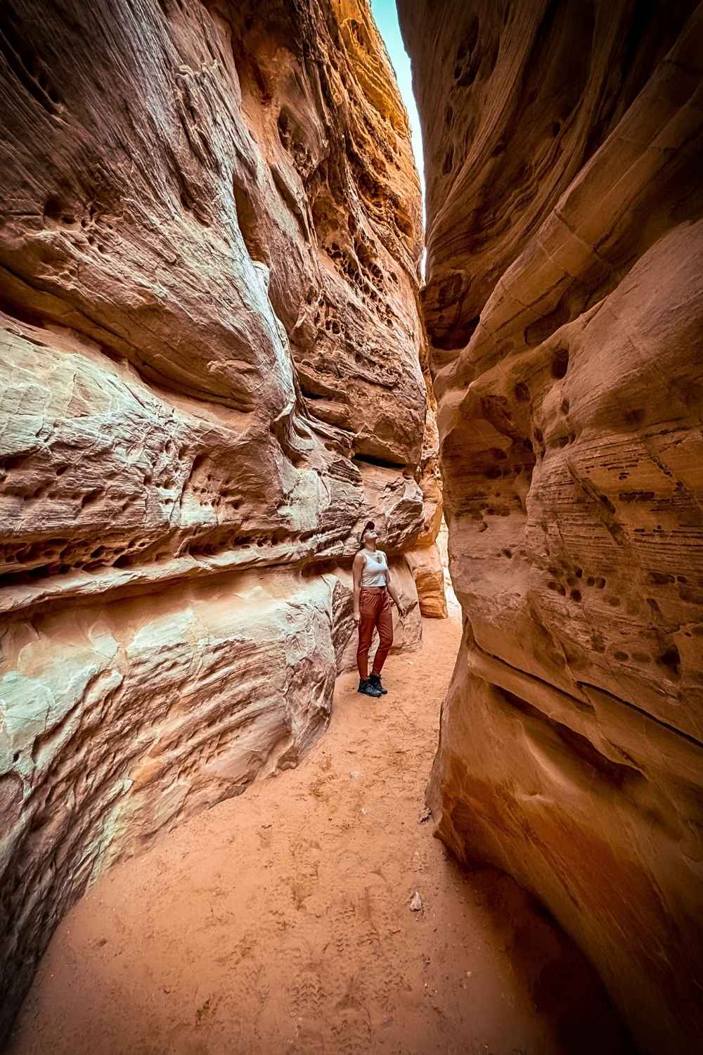
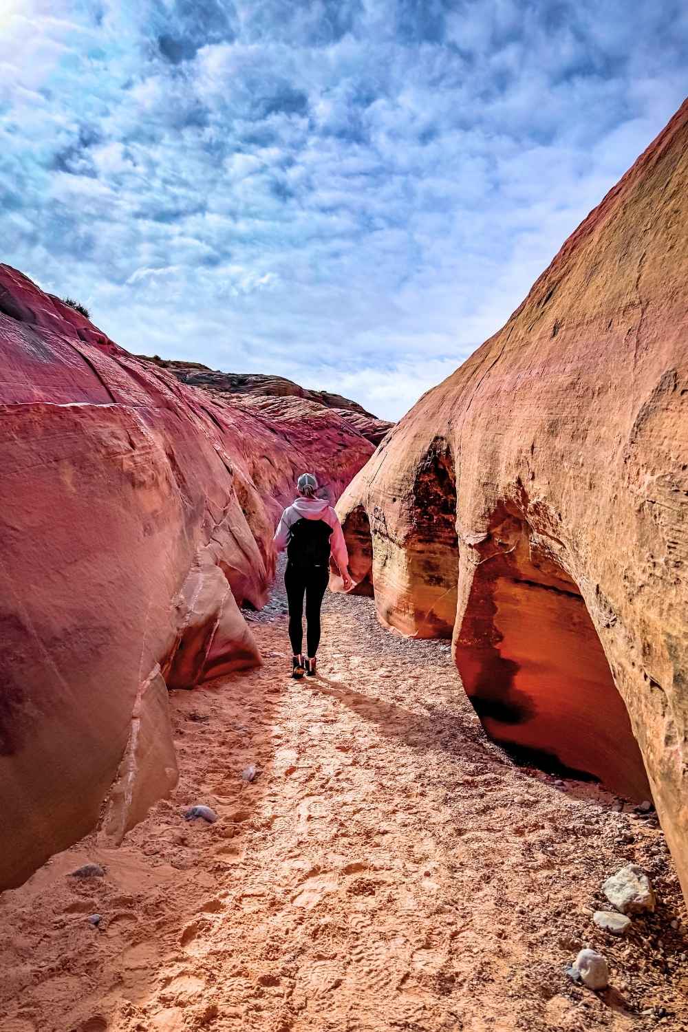
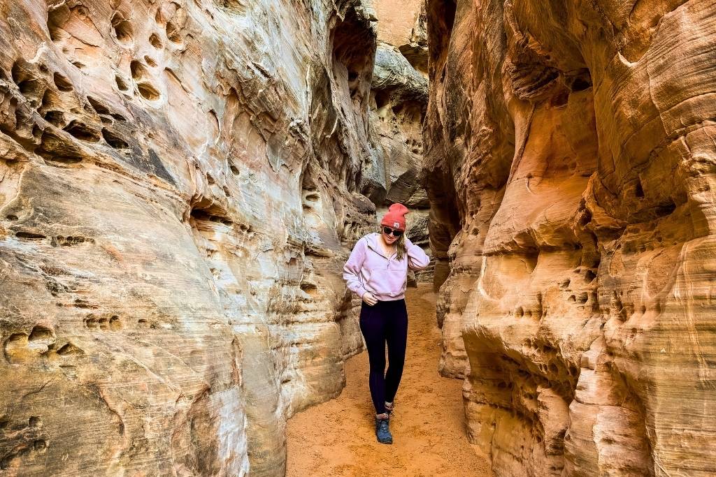
White Domes Trail
This was hands down my favorite hike in Valley of Fire—so much so that I did it twice!
I went back the next day on my way to Prospect Trail because I couldn’t get enough of the slot canyon section. It’s short but really fun to walk through and makes for some amazing photos. Just don’t forget to look up!
The trail also has the remains of an old movie set from the film “The Professionals” (1965), which adds a bit of cool history to the hike. If you only have time for one trail, this is a solid pick!
💡 Pro Tip: If you want the quickest route to the slot canyon, start the trail counterclockwise. Walk along the left side of the road away from the parking lot until you see an opening in the rock wall on the left with stone steps leading down.
Trail Details:
Location – Starts from the parking lot all the way at the end of Mouse’s Tank Road, where it dead ends.
Distance – 1.1-mile loop trail
Elevation Gain – 177 ft gain
Difficulty Level – Moderate, with rocky terrain and a bit of rock scrabbling
Estimated Time – 1-2 hours
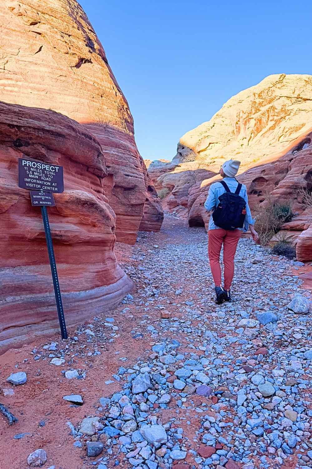
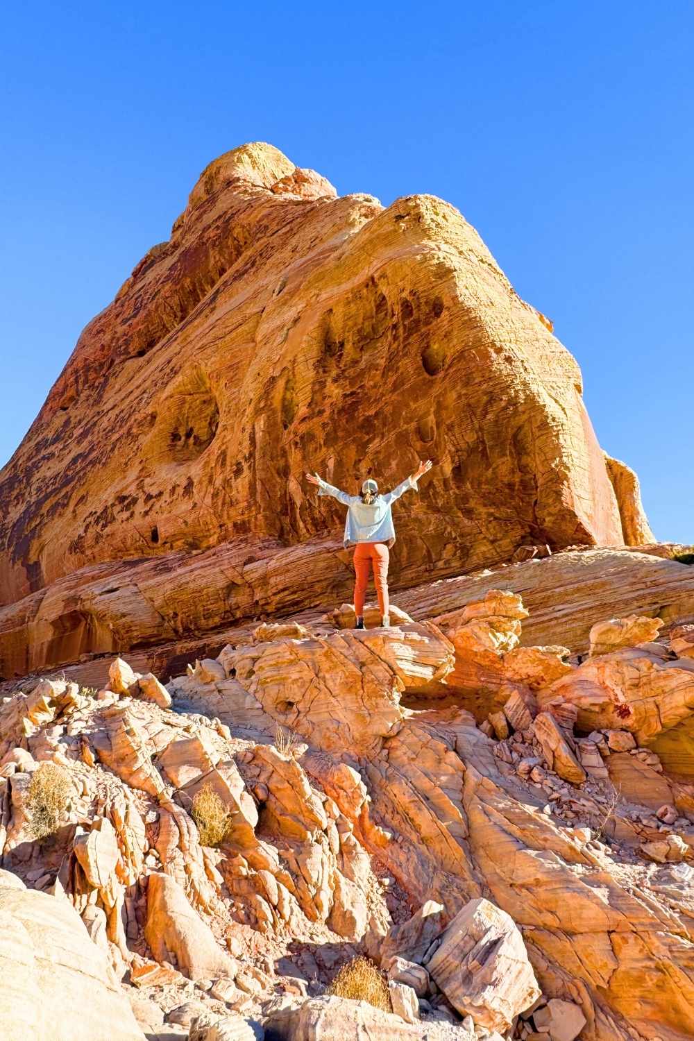
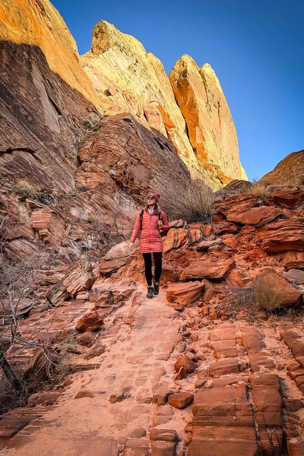
Prospect Trail
This is the longest trail in Valley of Fire, but you won’t find it on the brochure they hand out at the entrance. I only learned about it thanks to the park rangers at the visitor center, who pointed out several trails that aren’t on the map.
The full trail is a point-to-point route, meaning you’ll need someone to drop you off and pick you up. Since I didn’t have a buddy, I hiked a third of the way in from White Domes Trail and then backtracked.
The trail starts right after the slot canyon on White Domes, where you’ll see the sign. It’s not well-marked or maintained, and I had a hard time keeping track of the path, so I highly recommend downloading the route on AllTrails before setting out.
That said, it’s an amazing hike with incredible views and lots of rock scrambling, making it one of the more adventurous trails in the park.
Trail Details:
Location – Starts from the slot canyon on White Domes Trail.
Distance – 9 miles out and back
Elevation Gain – 770 ft gain
Difficulty Level – Moderate to Difficult, with quite a bit of rock scrambling
Estimated Time – 3-4 hours
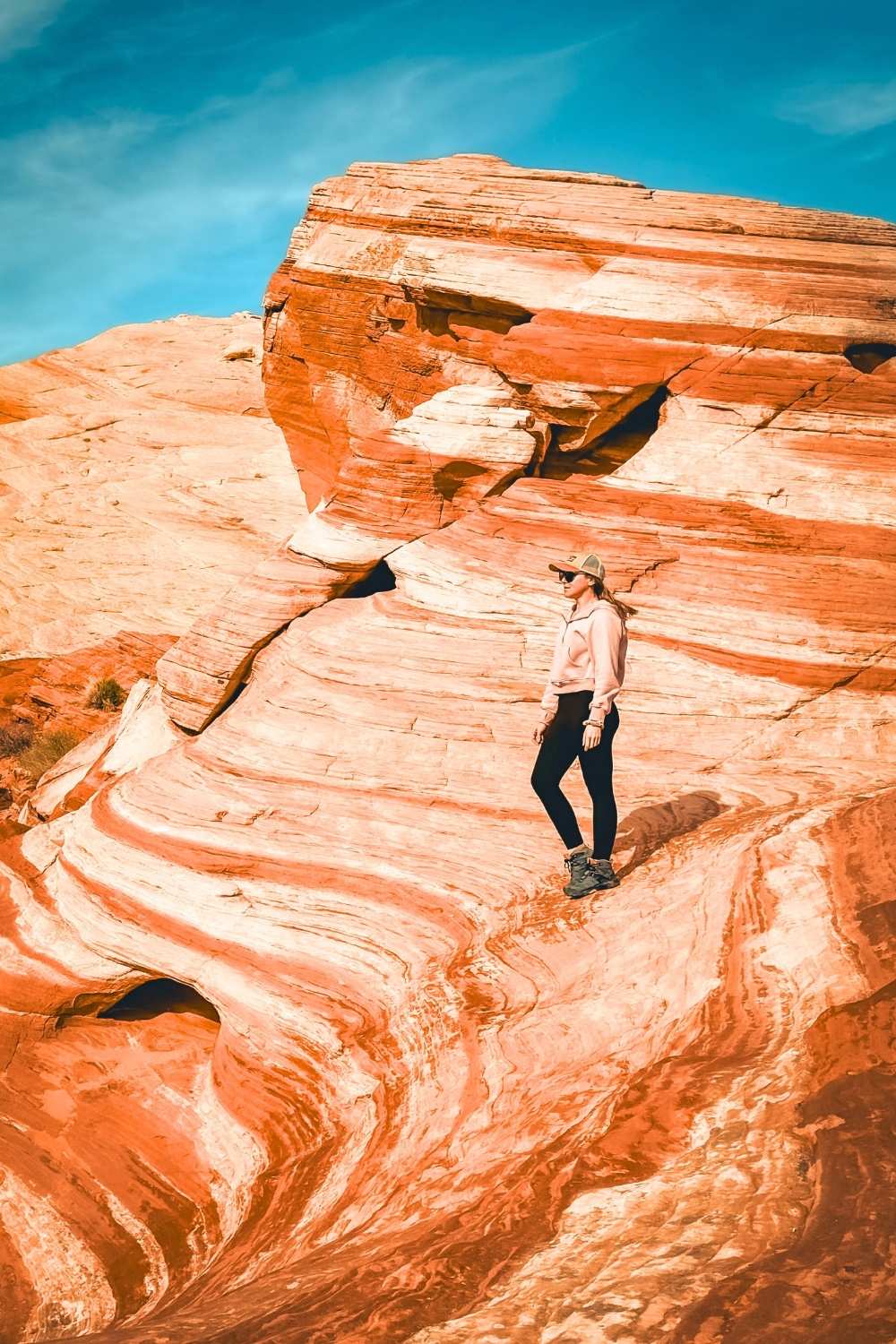
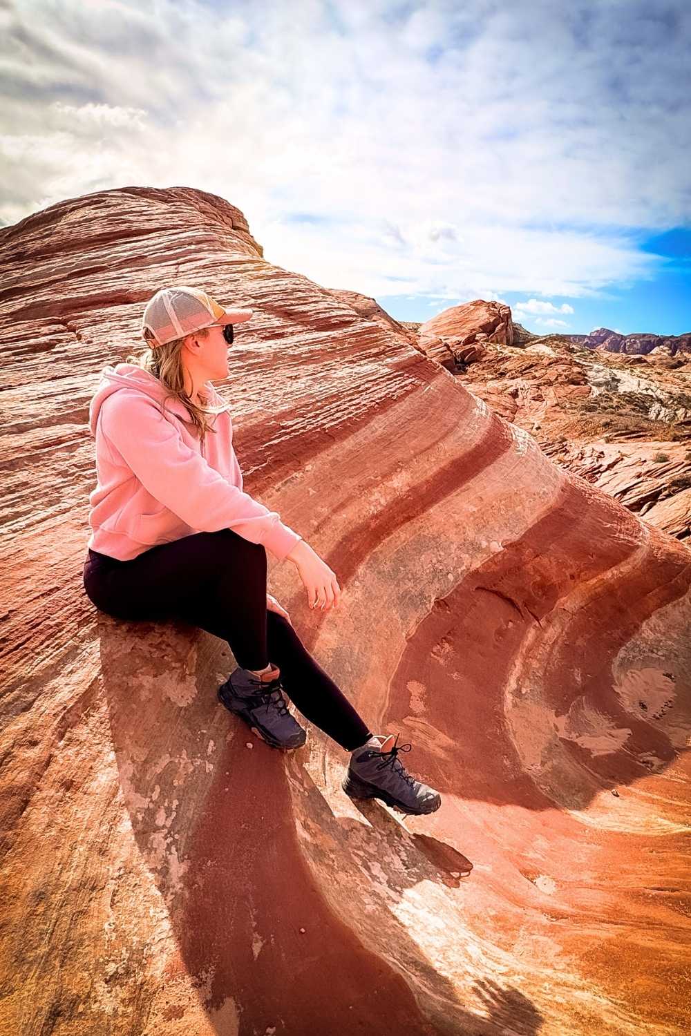
Fire Wave Trail
The Fire Wave Trail is one of the most popular hikes and attractions in the park, and for good reason. The swirling red and white sandstone looks like a mini version of the famous Wave in Utah.
The trail starts from parking lot P3 on the park brochure, but oddly, there’s no sign marking the trail or even the parking lot.
If you’re coming from the visitor center, the trail starts from the corner of the parking lot, on the right side of the road.
You’ll likely see plenty of foot traffic in the sand, so just follow the path until you hit solid rock, then look for the metal stakes guiding the way.
It’s pretty easy to navigate, and if you have time, I highly recommend continuing past Fire Wave to complete the Seven Wonders Loop for even more incredible sights.
💡 Pro Tip: Try to hike this trail at sunrise or sunset for better lighting and fewer crowds. The soft light really brings out the colors and swirls in the rock, making for the best photos.
Trail Details:
Location – Starts from the P3 parking lot on the park brochure
Distance – 1.5 miles out and back
Elevation Gain – 150 ft gain
Difficulty Level – Easy
Estimated Time – 30 minutes – 1 hour
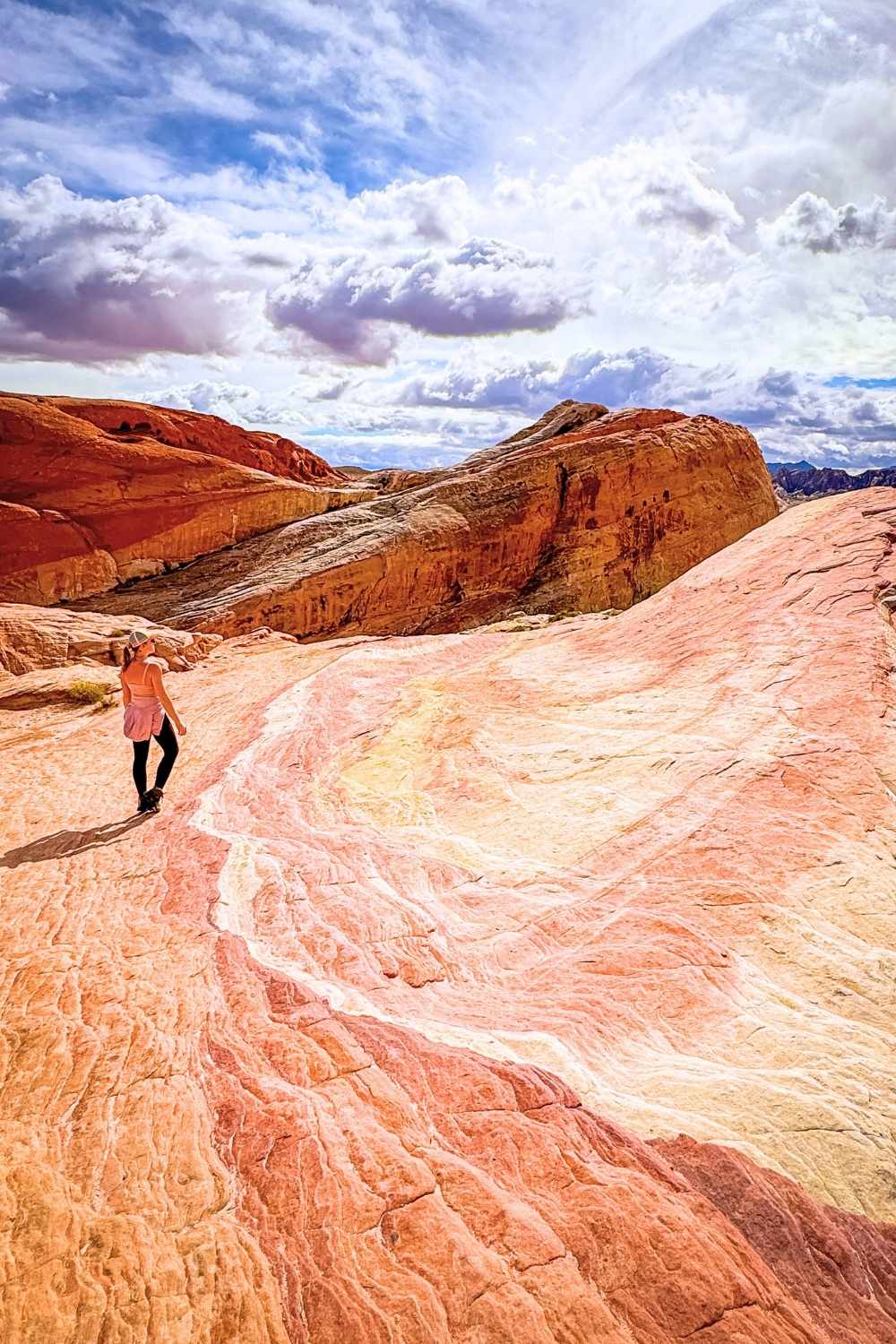
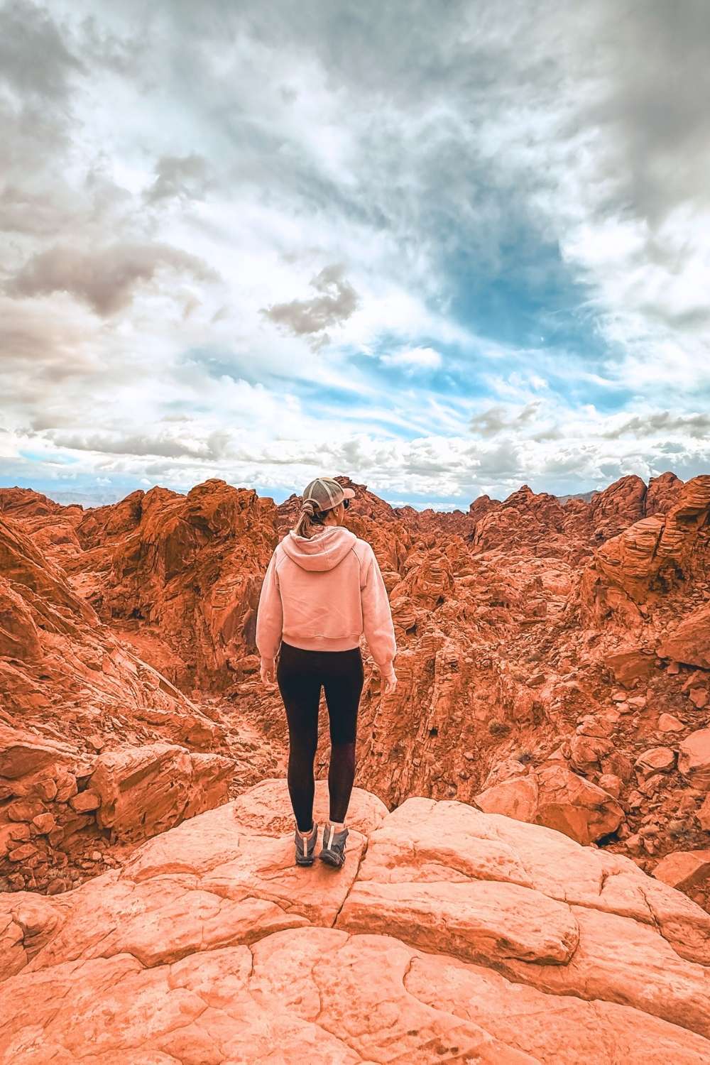
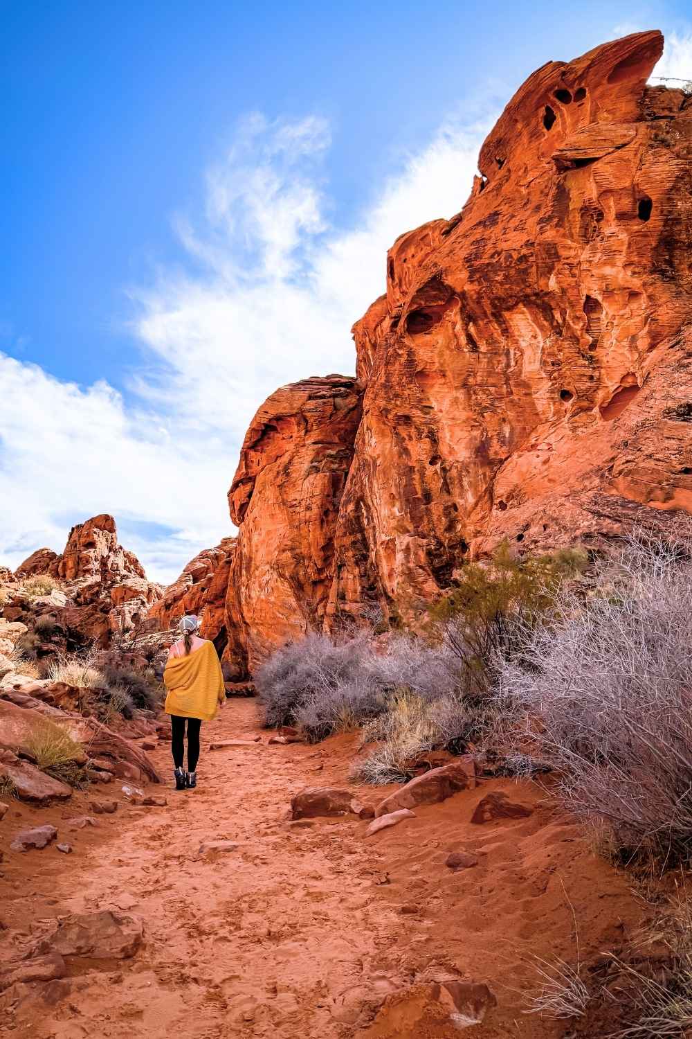
Seven Wonders Loop Trail
This was my second favorite hike in Valley of Fire, and I highly recommend it if you want to see more than just the Fire Wave.
The loop includes six other unique spots, including White Domes, Pastel Pink Canyon, Crazy Hill, Fire Cave, Striped Rock, and Thunderstorm Arch. Some of these features are a little hidden, so you’ll need to do some exploring to find them.
My personal favorite was Crazy Hill, which looks like a rainbow-colored river flowing down the rocks—it’s unlike anything else in the park!
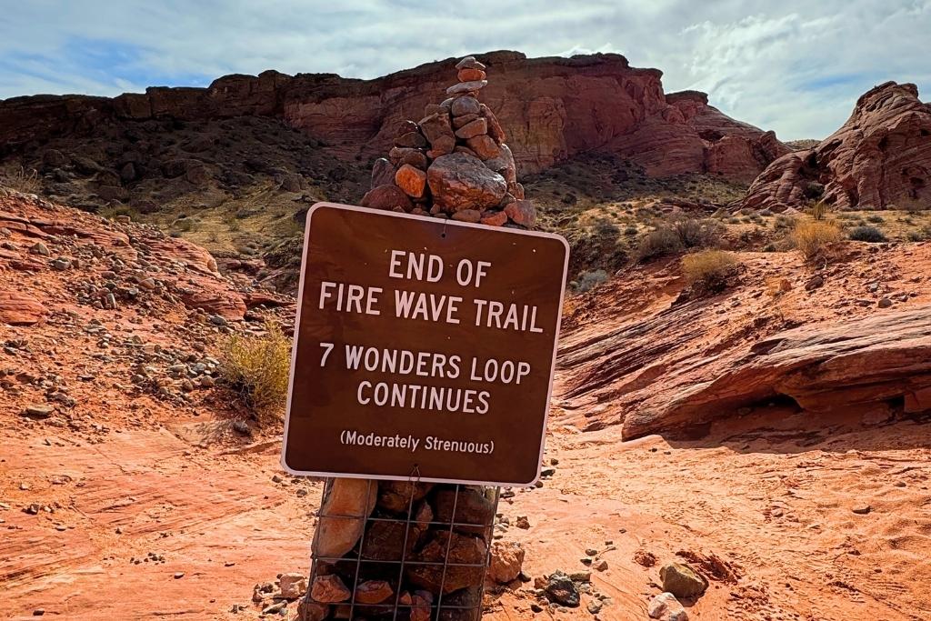
Just keep in mind that after Fire Wave, the trail isn’t well-marked, so I suggest downloading the AllTrails map before heading out. That said, this is one of the most popular trails in the park, so chances are you can follow other hikers if you’re unsure of the route.
💡 Pro Tip: Hike the Seven Wonders Trail clockwise, starting with Fire Wave. You’ll catch the best colors at Fire Wave and Pastel Canyon before the sun gets too high and washes them out.
Trail Details:
Location – Starts from the P3 parking lot on the park brochure
Distance – 1.9 miles loop
Elevation Gain – 187 ft gain
Difficulty Level – Moderate with some slick rock scrambling
Estimated Time – 1.5-2 hours
Rainbow Vista Trail
Rainbow Vista is a short, easy trail that’s open year-round, making it a great option for all skill levels.
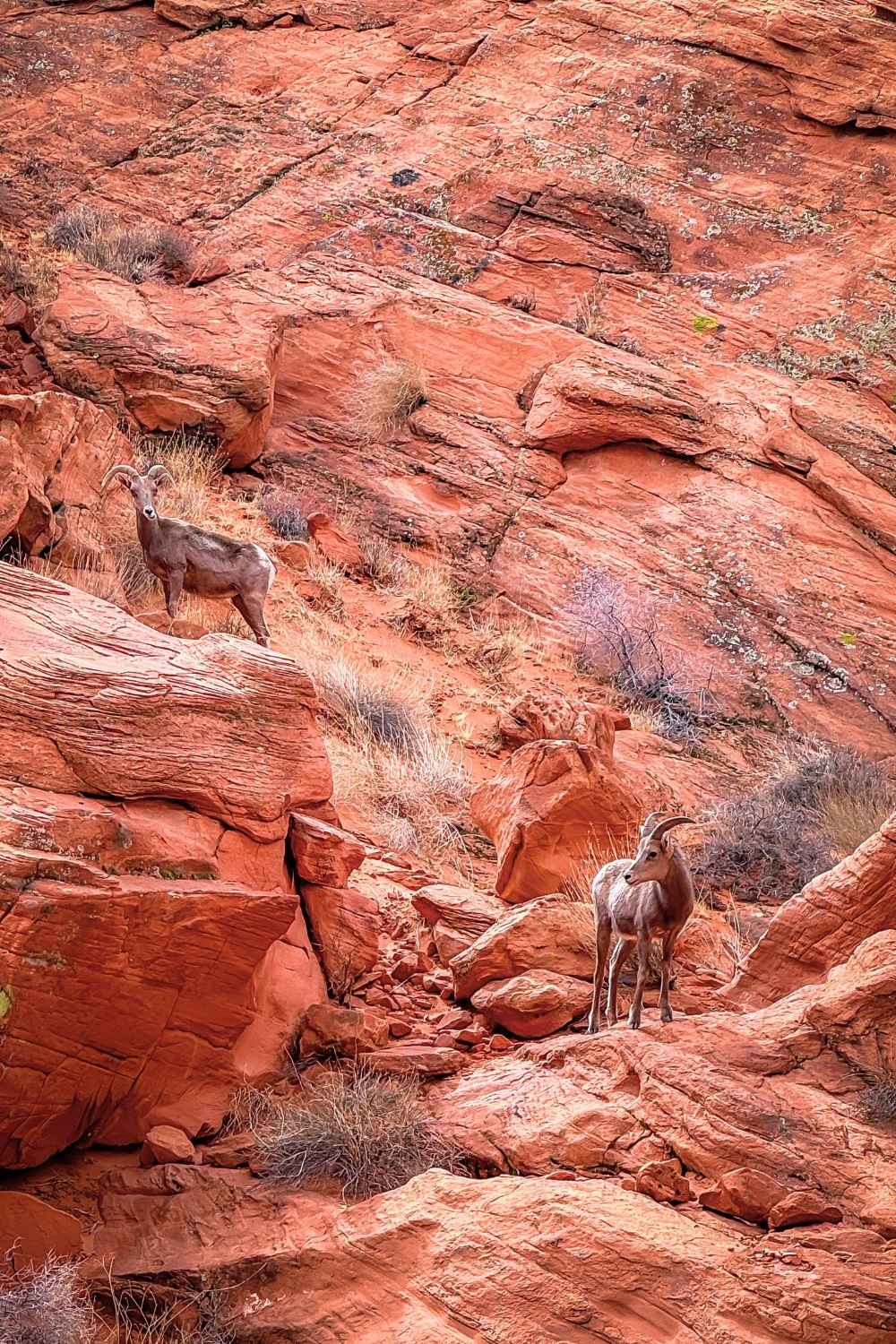
The path winds through a sandy wash and a narrow canyon, surrounded by stunning red rock formations. Keep an eye out for bighorn sheep along the way—I saw several, and they didn’t seem too bothered by me snapping photos!
The trail leads to the Fire Canyon Overlook, which offers one of the prettiest views in the park. Take some time to soak it in before heading back the way you came. PS. The best spot for views and photos is on top of the rocks to the left of the sign marking the end of the trail.
💡 Pro Tip: There is no shade on this trail, and the sand can get really hot, especially in the summer. Even though it’s a short walk, don’t wear sandals—the sand can burn your feet!
Trail Details:
Location – Starts from the Rainbow Vista parking lot on the side of Mouse’s Tank Road.
Distance – 1 mile out and back
Elevation Gain – 104 ft gain
Difficulty Level – Easy
Estimated Time – 30 minutes – 1 hour
Mouse’s Tank Trail & Petroglyph Canyon
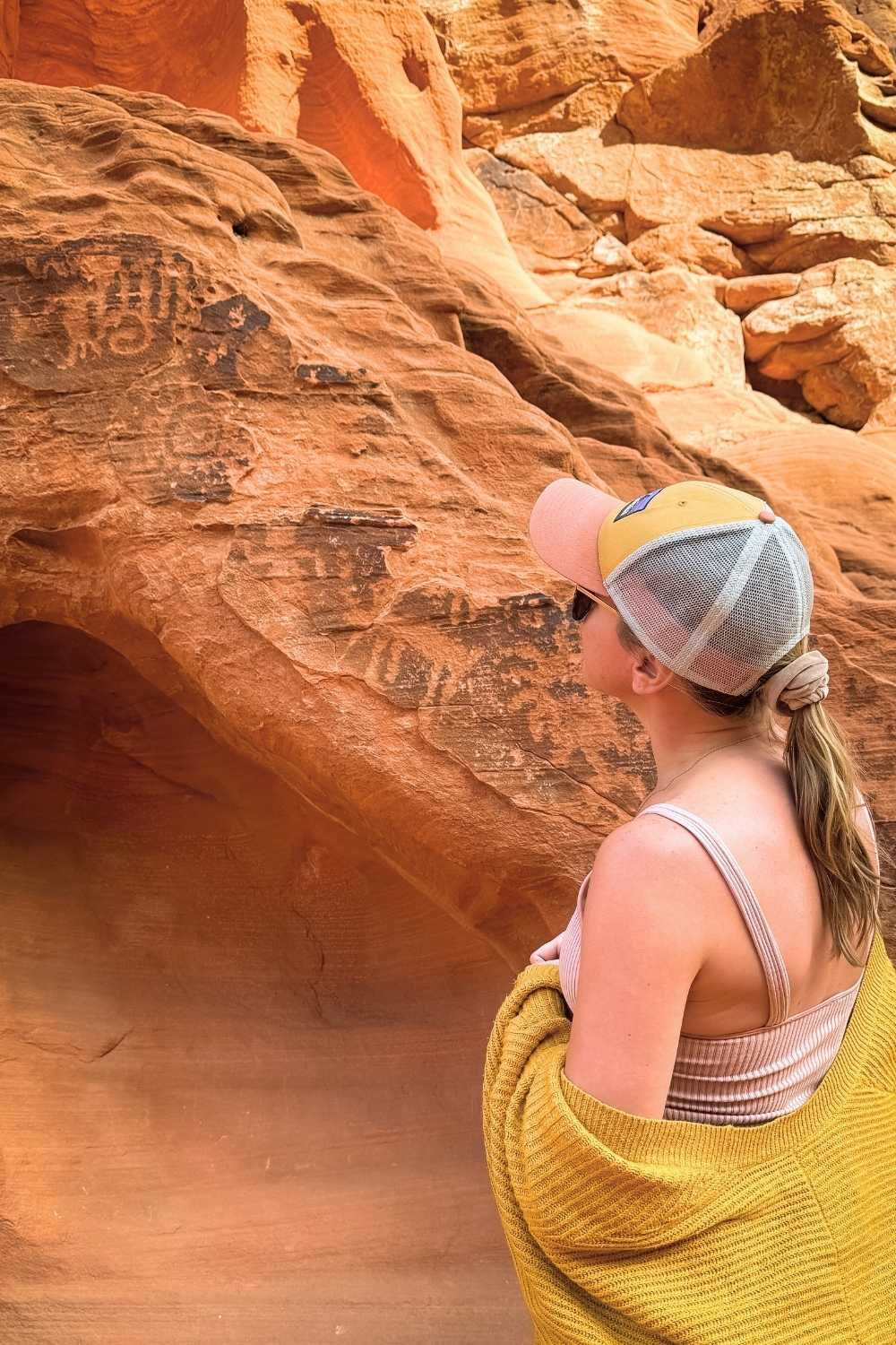
This is another short, easy hike, but this one is really unique in that it has lots of petroglyphs.
The trail follows a sandy path through Petroglyph Canyon, where I saw more petroglyphs in one place than anywhere else in my life.
Be sure to look for a large, tar-colored boulder off the left side of the trail that’s just covered in them. It’s like a giant doodle board of figures, animals, and symbols etched into the rock.
At the end of the trail, you’ll reach Mouse’s Tank, a sone basin between two boulders that collects and holds water during dry spells. Despite the name, it has nothing to do with the small furry animal—it’s actually named after a Paiute Indian called Mouse, who hid in this area long ago.
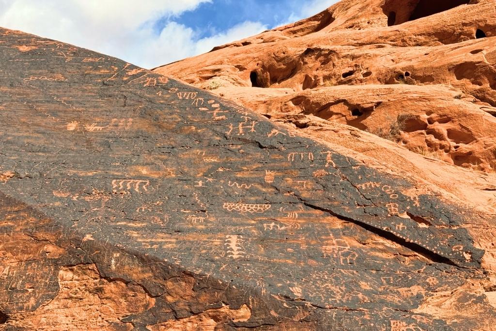
💡 Pro Tip: Please don’t touch or damage the petroglyphs—they can’t be repaired or replaced. Do your part to help preserve them for future visitors!
Trail Details:
Location – Starts from the Mouse’s Tank parking lot, 1 mile from the visitor center
Distance – 0.7 mile out and back
Elevation Gain – 49 ft gain
Difficulty Level – Easy
Estimated Time – 30 minutes – 1 hour
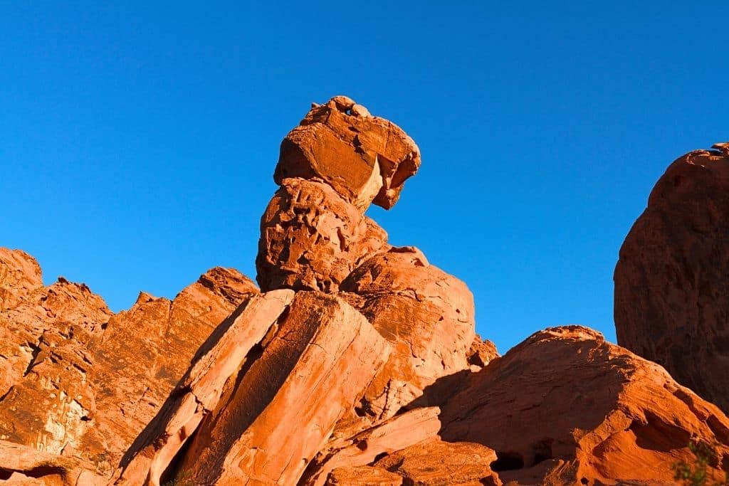
Elephant Rock Loop
Located at the East entrance of the park, this year-round trail showcases one of Valley of Fire’s most famous rock formations—Elephant Rock.
While almost everyone stops to snap a quick photo of it, very few people hike the full loop, making it a great option if you’re looking for a quieter trail with fewer crowds. I hiked it just before sunset and only passed three other people, which made for a peaceful hike.
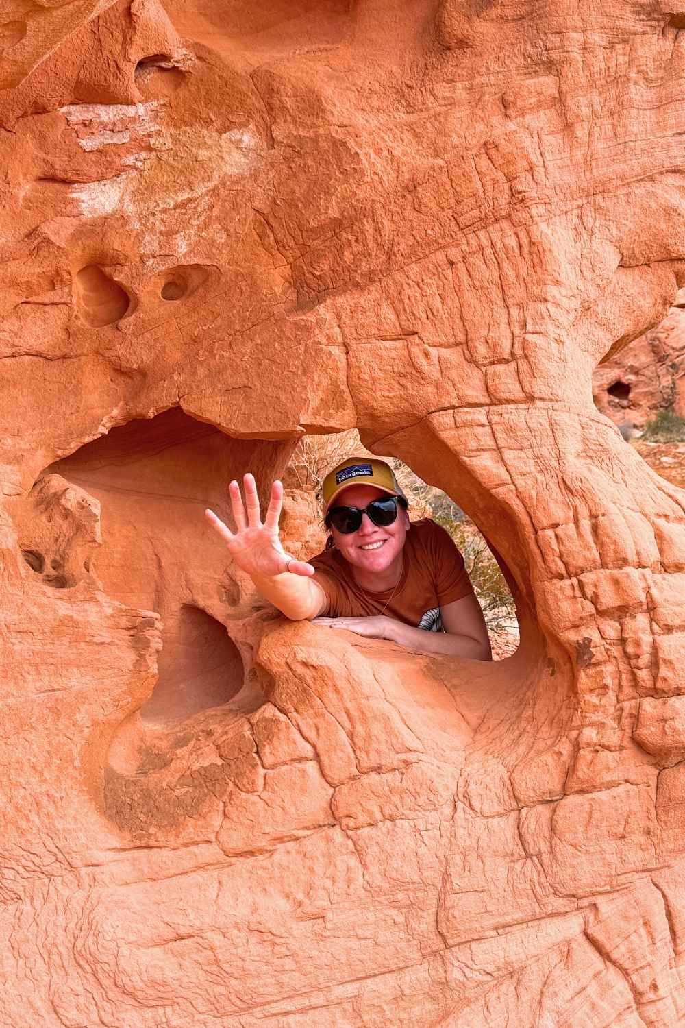
The trail offers beautiful valley views and plenty of fun rock formations and caves to explore along the way.
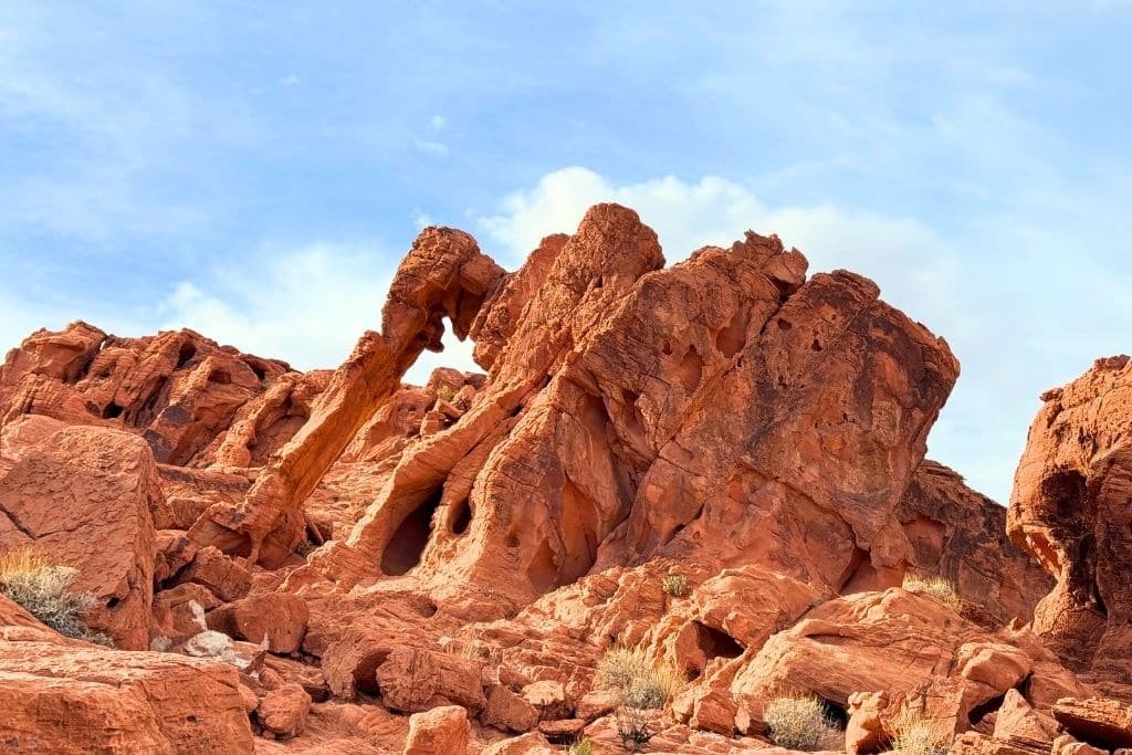
If you’re just here for Elephant Rock, it’s only 0.2 miles from the parking lot, but just know that the narrow trail runs right along the highway, so be careful!
Trail Details:
Location – Starts from the East entrance parking lot
Distance – 1.3 mile loop
Elevation Gain – 173 ft gain
Difficulty Level – Easy
Estimated Time – 30 minutes – 1 hour
Pinnacles Trail
I didn’t get a chance to hike the Pinnacles Trail, but I seriously considered it over Prospect Trail since I could have started right from my campsite in the campground.
This trail isn’t listed on the park brochure, and I only learned about it from talking to the rangers at the visitor center.
They told me it’s a mostly flat hike through open desert prairie, leading to the Pinnacles, a cluster of towering rock formations at the far end of the loop.
The real highlight is a steep staircase that takes you up into the formations, where you’ll find petroglyphs and stunning views.
I wish I had time to check it out—it sounds like an awesome off-the-radar trail if you are wanting a less crowded hike.
Trail Details:
Location – Starts from the Atlatl Rock parking lot
Distance – 4.8 mile loop
Elevation Gain – 429 ft gain
Difficulty Level – Moderate
Estimated Time – 2-2.5 hours
Balancing Rock Trail
This isn’t really a hike—it’s more of a short walk from the visitor center to one of Valley of Fire’s most famous rock formations.
As the name suggests, it looks like a massive boulder precariously teetering on top of a rock spire, as if one strong gust of wind could send it crashing down. (Don’t worry—it’s been standing for centuries and has even survived multiple earthquakes.)
Still, you might think twice before standing directly underneath it!
This area is also a hotspot for bighorn sheep, so keep your eyes peeled—you might just get lucky and spot a few hanging out nearby.
Trail Details:
Location – Starts from the visitor center parking lot
Distance – 0.3 mile out and back
Elevation Gain – None
Difficulty Level – Super easy
Estimated Time – 15 minutes
Other Hikes in Valley of Fire Worth Considering
If you’re looking to escape the crowds, these lesser-known trails might be worth checking out. They’re not as popular as the main attractions, so there’s a good chance you’ll have the trail all to yourself.
Old Arrowhead Trail
This is one of the longer trails in Valley of Fire, starting near Elephant Rock at the East entrance. It’s an easy, 7-mile point-to-point trail, but because it’s not well-known, you’ll probably have it all to yourself. The trail offers nice desert views, but keep in mind that there’s no shade, so bring plenty of water and sun protection. Expect to spend around 2.5 hours to complete it.
Natural Arch Trail
Although the natural arches have collapsed, park rangers at the visitor center still recommend this hike for its scenic rock formations. Since the arches no longer exist, this 1.2-mile out-and-back trail is rarely crowded, making it a good option if you’re wanting a quiet hike.
Tips For Hiking in Valley of Fire State Park
Hiking in Valley of Fire is an unforgettable experience, but the desert environment comes with some challenges. To make the most of your visit (and avoid common mistakes), keep these tips in mind before hitting the trails.
Annual Trail Closures
Many of the Valley of Fire trails close from May to October due to extreme heat. Temperatures can soar well over 100°F, making hiking dangerous. These closures are in place to protect visitors, so if you’re planning a trip during the summer, check which trails are open before you go.
Bring More Water Than You Think You Need
There are no water sources on the trails, so you need to bring all the water you’ll need for the day. A good rule of thumb is at least one gallon per person per day. If you’re hiking in warm weather, consider bringing electrolytes to help you stay hydrated.
No Cell Service
Cell service is nonexistent inside the park, except for some coverage at the East and West entrances. I hear there’s also spotty reception at Fire Canyon Overlook, but don’t count on it. I couldn’t pick it up. If you need navigation or trail maps, download them in advance or pick up a map at the visitor center.
Pets
Pets are allowed in the park and on the trails, but they must be on a leash at all times. Keep in mind that the sand and rocks get extremely hot, so if you’re bringing your dog, plan for early morning or late evening hikes to avoid burned paws.
Appropriate Footwear
I saw people attempting to hike even the shortest and easiest trails in flip-flops, and it did not go well. The fine sand on the rocks is incredibly slippery, and I even saw someone break their sandal strap, leaving them to walk out barefoot. Not only that, but the hot sand dunes you’ll walk through can burn your feet, especially in the summer months. Wear proper hiking shoes, please!
Limited Parking
Popular trailheads fill up quickly, especially Fire Wave, White Domes, and Mouse’s Tank. Arrive early to snag a spot, or be prepared to wait for a space to open up. Whatever you do, don’t park on the road—it’s illegal, and you could get towed.
Where to Stay
There are a few options to choose from when visiting Valley of Fire. Here’s a breakdown of the best places to stay, from campgrounds inside the park to hotels in nearby towns.
Camping in the Park
Valley of Fire has two campgrounds with a total of 72 campsites. They used to be first come, first served, but with the park’s growing popularity, you’ll want to book in advance online to secure a spot. You can go to Reserve Nevada website and make your reservations.
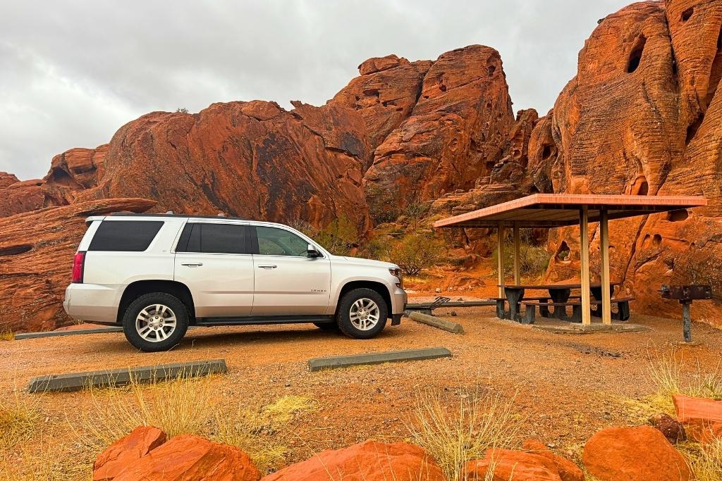
⛺ Arch Rock Campground: This is the campground I stayed in, and in my opinion, it’s the best one in the park. The campsites are tucked right among the red rock formations, making for an incredibly scenic camping spot. The higher the numbers, the more secluded the camp spots.
🚐 Atlatl Rock Campground: If you’re bringing an RV, Atlatl Campground is the better choice since it has RV hookups and even showers. The sites are spacious and still have great views, but they’re not as tucked into the rocks as Arch Rock.
Both campgrounds have covered picnic areas, water access, and fire pits, so no matter which one you choose, you’ll have everything you need for a great camping experience. There’s even a dumping station between the campgrounds.
Dispersed Camping Near the Park
If you prefer free camping, there’s a great BLM dispersed camping area just 10 minutes outside the park near Overton, NV. It’s right off the main road, super easy to access, and has level ground with great desert views. Plus, unlike inside the park, you’ll actually have cell service here, which is a huge bonus.
📍 BLM Dispersed Camping near Overton, Nevada
Coordinates: 36.44394235 N, 114.67516382 W

Best Hotels Near the Park
If camping isn’t your thing, your best bet is to stay in a nearby town like Overton, Henderson, or the outskirts of Las Vegas, all of which offer easy access to the park.
I’ve included the three best hotels near the park:
🏨 North Shore Inn at Lake Mead – This is the closest hotel to Valley of Fire, located just 9 miles away. It’s an affordable option with super easy access, especially if you want to get to the park early and beat the crowds.
🏨 The Westin Lake Las Vegas Resort & Spa by Marriott – Located 31 miles from the park in Henderson, NV, this is a great relaxing option after a long day of hiking. It even has a spa to help you unwind! Bonus—it’s pet-friendly, which is perfect if you travel with your furry friend like I do.
🏨 La Quinta Inn & Suites by Wyndham Las Vegas Nellis – Located 33 miles from the park in Nellis, NV, this hotel is a solid choice if you want to avoid Las Vegas traffic. I’ve stayed at La Quinta multiple times, and they’ve always been reliable and comfortable. Plus, it’s pet-friendly and has a pool, which is perfect for cooling off after a hot day on the trails.
FAQ’s
You ask and I answer. Here are some of the most common questions to help you plan your visit.
What is the best hike in Valley of Fire?
In my opinion, White Domes Trail is the best hike in Valley of Fire. It has stunning red rock formations, white domes that contrast the red rocks, beach-like sand dunes, and a fun slot canyon to explore. And even ruins from an old movie set built in 1965 for the film The Professionals. I enjoyed it so much that I actually hiked it twice!
Can I do Valley of Fire in a day?
Yes, you can see the main highlights in one day and still get a good feel for the park. If you’re short on time, focus on Fire Wave, White Domes, and Mouse’s Tank Road. But if you can, I highly recommend spending at least one night in the park—this gives you a full 24 hours to explore and beat the crowds in the early morning and late evening.
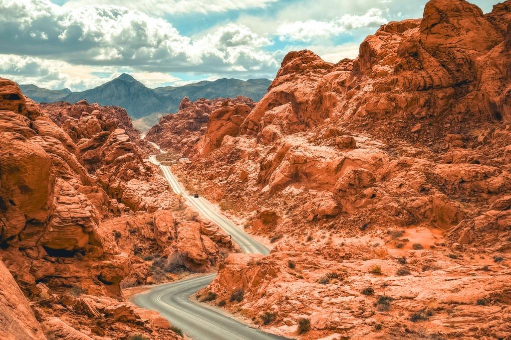
Can you just drive through Valley of Fire?
Yes, you can drive through the park, and the scenery is still incredible. But if you want to see the most stunning part of Valley of Fire, take a detour up Mouse’s Tank Road—it’s an out-and-back drive with some of the best views in the park. Even if you’re short on time, it’s worth the detour. Just note there is a $10-15 entrance fee.
Is Valley of Fire worth seeing?
Absolutely! This may be a small state park, but it’s packed with incredible rock formations, scenic hikes, and unique landscapes. If you’re visiting Las Vegas or nearby, don’t skip it—it’s one of the most stunning places in Nevada.
When is the best time to visit Valley of Fire?
The best time to visit is spring and fall, when temperatures are mild and crowds are smaller. I went in February, and the weather was perfect for hiking and camping—I even had some trails all to myself! Just keep in mind that summer gets extremely hot, and many trails close from May to October to protect visitors from the dangerous heat.
📌 Love it? Pin it!
That’s a Wrap
There you have it. I hope I’ve helped you narrow down the best Valley of Fire hikes you want to conquer on your trip.
Just remember to bring plenty of water, hit the trails early, and please wear proper hiking shoes!
I loved my time exploring this unique landscape, and I know you will, too.